In 2005, a team of scientists conducted a side-scan sonar survey of the USS Macon wreck site in the Monterey Bay National Marine Sanctuary to record the extent of the debris field in preparation of the remotely operated vehicle (ROV) survey in 2006. To learn more about the 2005 expedition, see the June 2005 issue of the NOAA Report.
 |
|
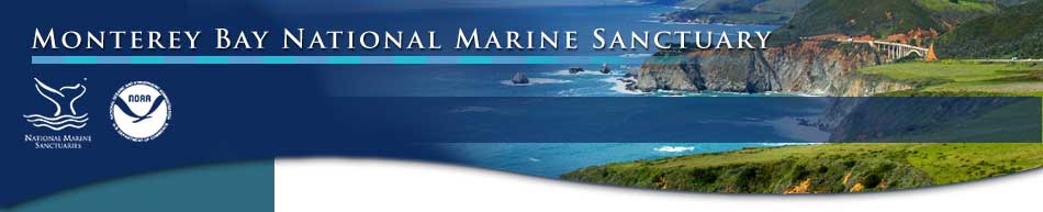
Schematic diagram of a sidescan sonar towed instrument insonifying the seafloor (top) and the sidescan data record created (bottom). The intensity of sound reflected back from rocks, sediment and other features provides information on the distribution and characteristics of the seafloor morphology. Strong reflections (high backscatter) from boulders, gravel and positive topographic features facing the instrument are white and weak reflections (low backscatter) from finer sediments and shadows are in black.
Credit: U.S. Geological Survey Seafloor Mapping Technology Web site |
|
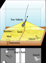
| This side-scan sonar instrument is towed behind a research vessel, produces sound waves, and records the intensity of sound reflected back. Scientists use this technology to create images of the seafloor.
Credit: NOAA |
|
 |
|
 |
|
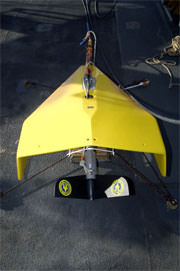
A side scan sonar tow fish is being deployed off the back deck of NOAA research vessel McArthur II.
Credit: Robert Schwemmer |
|
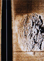
Side-scan image of one of the major debris fields of the USS Macon that includes four Curtiss F9C-2 Sparrowhawk aircraft.
Credit: Robert Schwemmer |
|
 |
|
 |
|
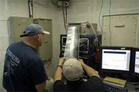
Principal Investigators Chris Grech (MBARI) and Roberto Anima (USGS) review the paper printout of the USS Macon side-scan sonar survey onboard the NOAA research vessel McArthur II.
Credit: Robert Schwemmer |
|