Climate & Meteorology
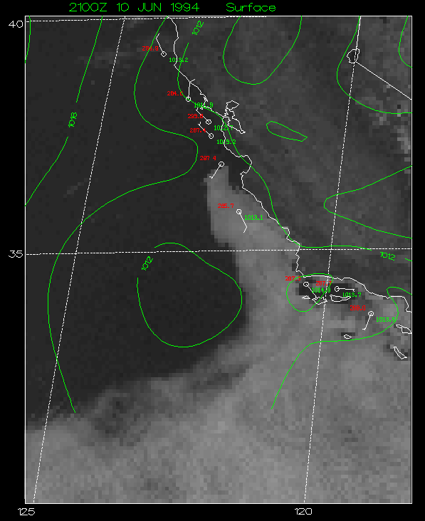
Figure 4
Visible satellite image over California from 10 June 1994. Surface ship and buoy observations and sea-level pressure contours are every 2 mb. Station plots show wind barbs where a full barb is 10 knots and half barb is 5 knots. Also plotted on station plot are observed values of temperature in K and pressure in mb.