Diving in the Sanctuary
The Monterey Bay National Marine Sanctuary extends from just north of the Golden Gate in Marin County to Cambria in San Luis Obispo County, encompassing 300 miles of shoreline and 6,094 square statute miles (4,601 nmi2) of ocean. It is home to numerous mammals, seabirds, fish, invertebrates, and plants, in a remarkably productive coastal environment. The Sanctuary is also home to some of the best diving in northern and central California. Divers can experience kelp forests, rocky reefs, shale beds, deep reefs, pinnicles,wharf pilings, eelgrass beds, and sandy flats all in relatively close proximity.
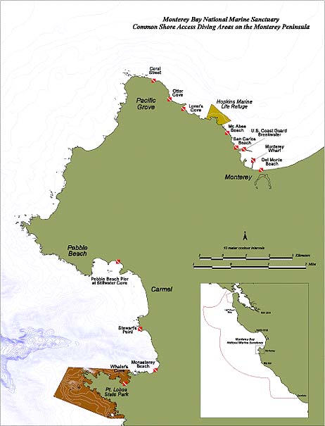
The following map highlights some of the common shore access diving areas on the Monterey Peninsula, a popular and world-class dive area. There are many other excellent dive locations on the Monterey Peninsula (accessble by boat) or in other areas of the Sanctuary, but at this time, we have only identified the safest and most easily accessible sites. Regardless of where you plan to dive, please consult a more detailed dive guide and map in the area you intend to dive. They are available from your local dive shop. Have a safe and enjoyable dive!