Overflight Map
GIS map illustrating the four NOAA regulated overflight zones. Please visit the following web page for more information.
- Map Image (650 x 841; 360K jpg)
- Map Image Full (2000 x 2588; 2M jpg)
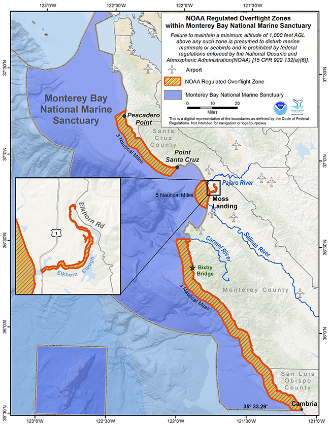

GIS map illustrating the four NOAA regulated overflight zones. Please visit the following web page for more information.