
Sanctuary Maps
A variety of maps showcasing sanctuary bathymetry, regulatory zones, watersheds and scientific information. Many are downloadable and some are interactive.
|
||||
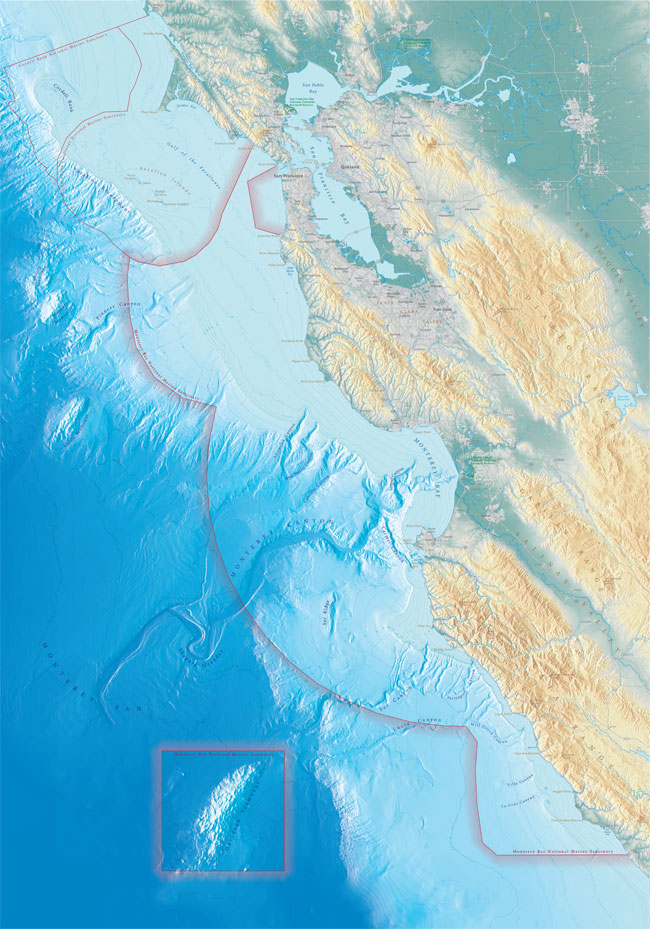 |
MBNMS Foundation MapA map of Monterey Bay National Marine Sanctuary, featuring bathymetric and topographical information. The spectacular image is ideal for education purposes, map lovers and anyone that appreciates beautiful art.
|
|||
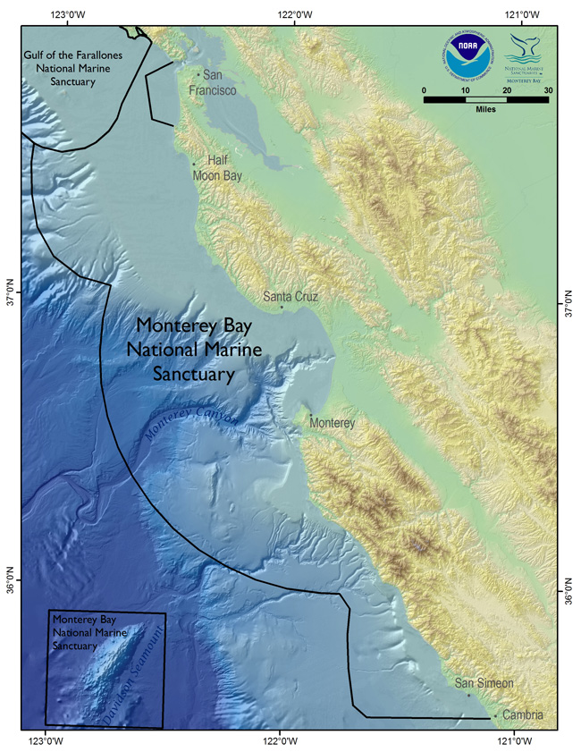 |
MBNMS Map - ColorMBNMS color map including bathymetry and hillshade.
|
|||
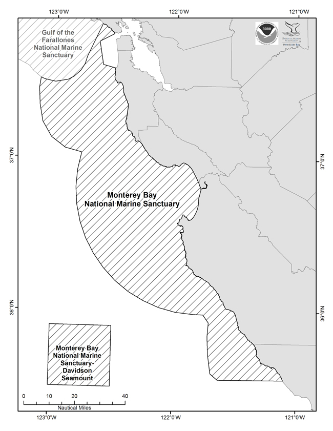 |
MBNMS Map - Black & WhiteMBNMS black and white map of the Sanctuary and county boundaries.
|
|||
|
|||
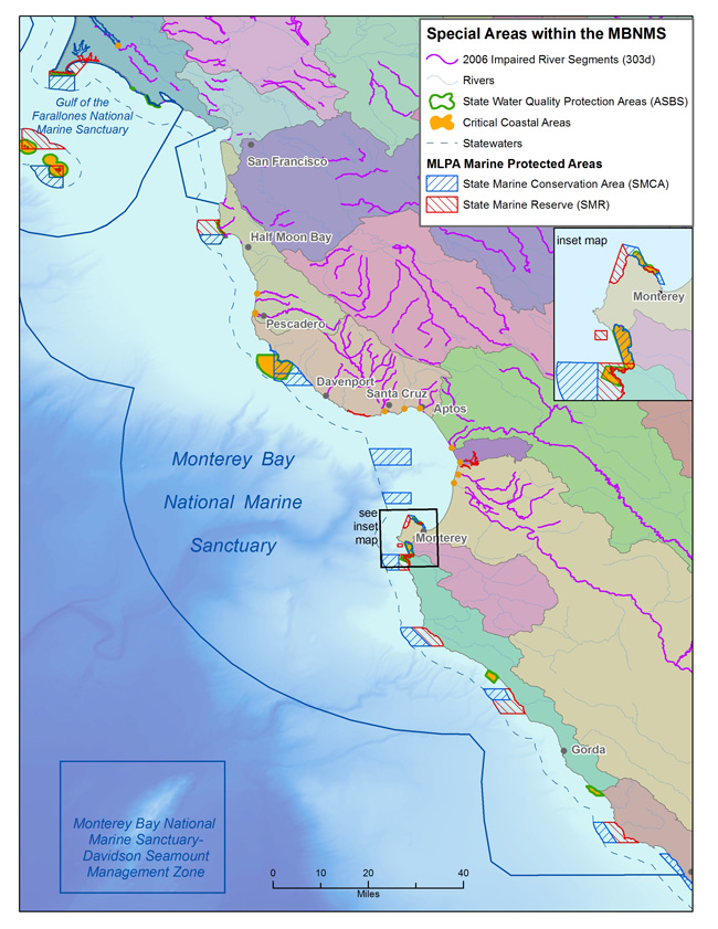 |
Critical Coastal Areas MapThe Critical Coastal Areas (CCA) Program fosters collaboration among local stakeholders and government agencies, to better coordinate resources and focus efforts on coastal watersheds in critical need of protection from polluted runoff. Please visit the following web page for more information.
|
||
 |
NOAA's Northern and Central California Biogeographic AssessmentAccess over one hundred maps showing densities and common locations of many animals, from seabirds to blue whales *this does not include Davidson Seamount Management Zone (DSMZ) since the assessment was done prior to DSMZ incorporation* |
||
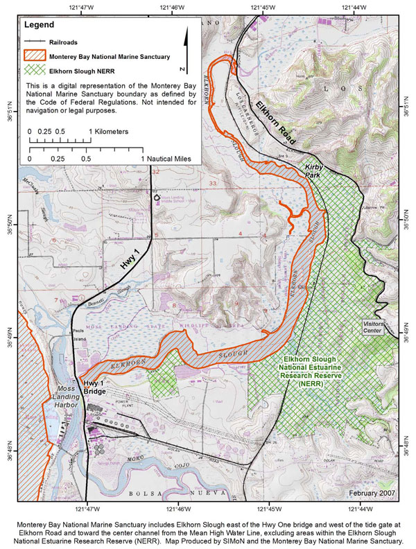 |
Elkhorn Slough MapThe main channels of the Elkhorn Slough fall under the Monterey Bay National Marine Sanctuary jurisdiction. The surrounding marsh areas are under the Elkhorn Slough National Estuarine Research Reserve jurisdiction.
|
||
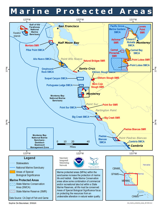 |
MPA and ASBS Sites in the MBNMSAreas of Special Biological Significance are a subset of state water quality protection areas that protect resources from an undesirable alteration in natural water quality. Please visit the following web page for more information.
|
||
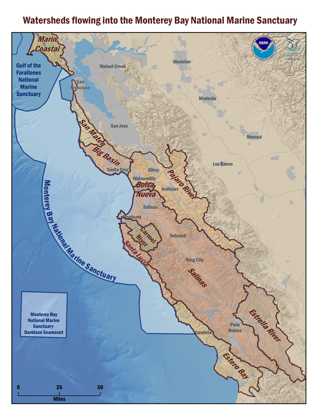 |
Watersheds in the MBNMS RegionThe Monterey Bay National Marine Sanctuary receives runoff from watersheds that cover an extensive area. Please visit the following web page for more information.
|
||
 |
SIMoN Interactive MapThree differently-themed interactive maps. Customize and print your own map |
||
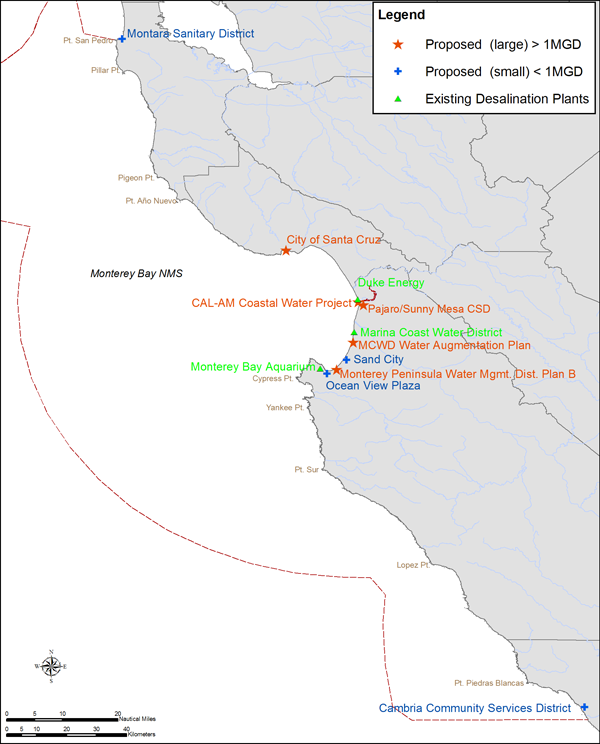 |
Desalination MapExisting and potential desalination plants in the Monterey Bay National Marine Sanctuary. Please visit the following web page for more information.
|
||
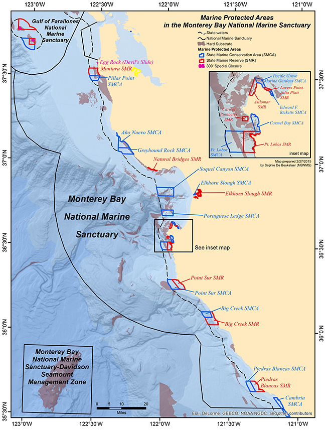 |
Marine Protected Areas in the MBNMSThe Marine Life Protection Act (MLPA) directs the state to reevaluate and redesign California's system of marine protected areas (MPAs). This map portrays both the Central Coast MPAs (implemented in 2007) and the North Central Coast MPAs (implemented in 2009) within the MBNMS. |
||
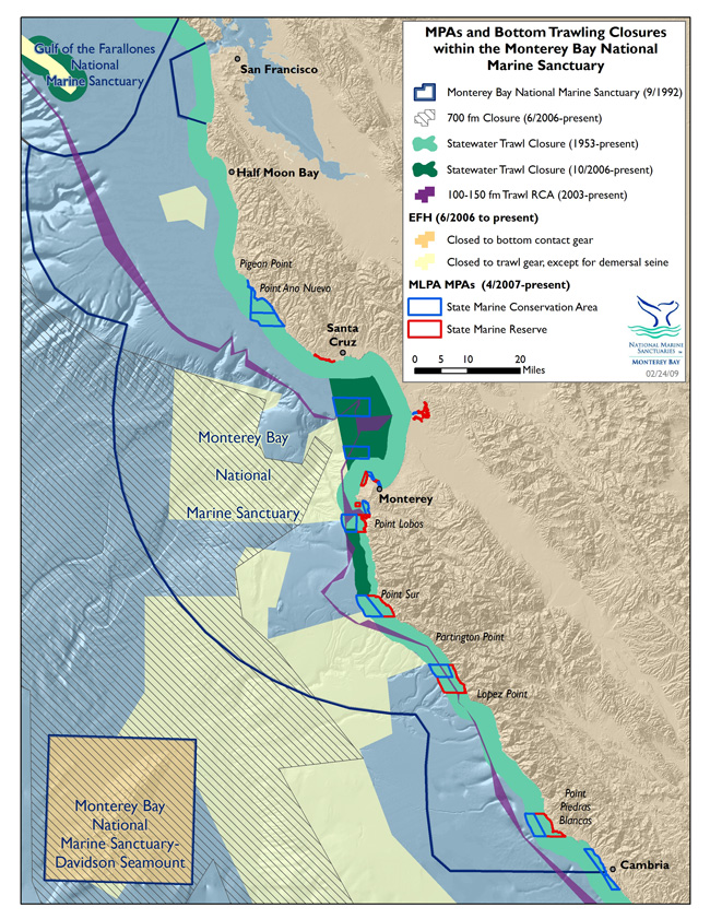 |
Marine Protected Areas and Trawling Closures in the MBNMSGroundfish closed areas specific to particular gear types transect the Monterey Bay National Marine Sanctuary. Please visit the following web page for more information.
|
||
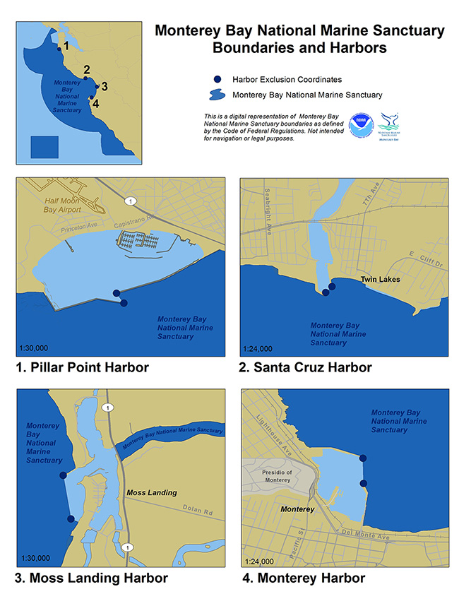 |
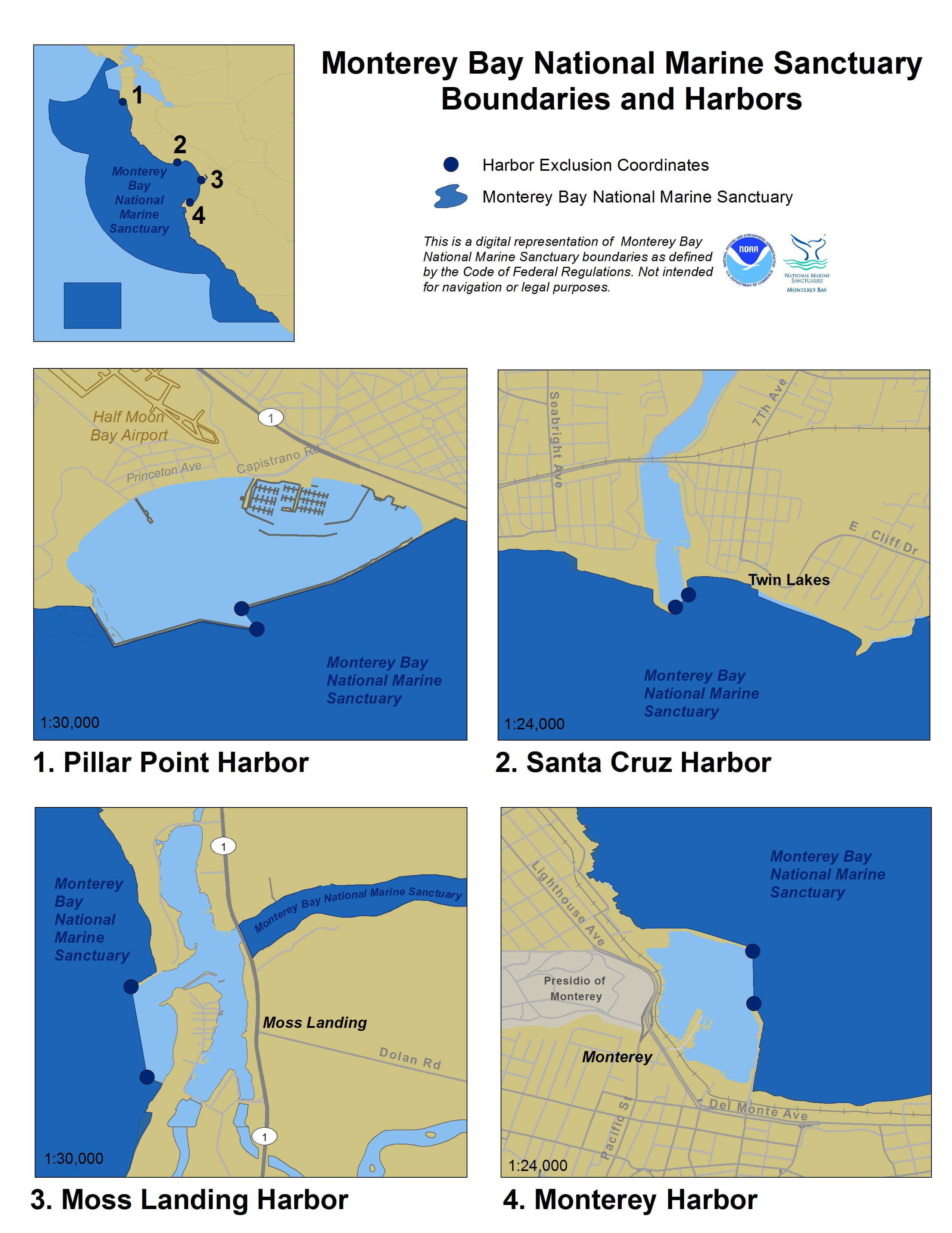
MBNMS Boundaries Around HarborsThis map provides a closer look at MBNMS boundaries around harbors, including Monterey, Moss Landing, Santa Cruz and Pillar Point.
|
||
|
|||
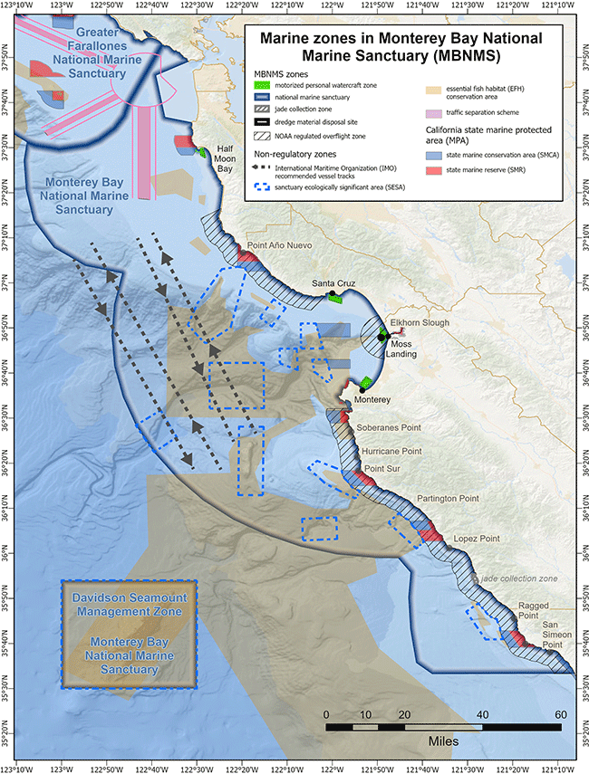 |
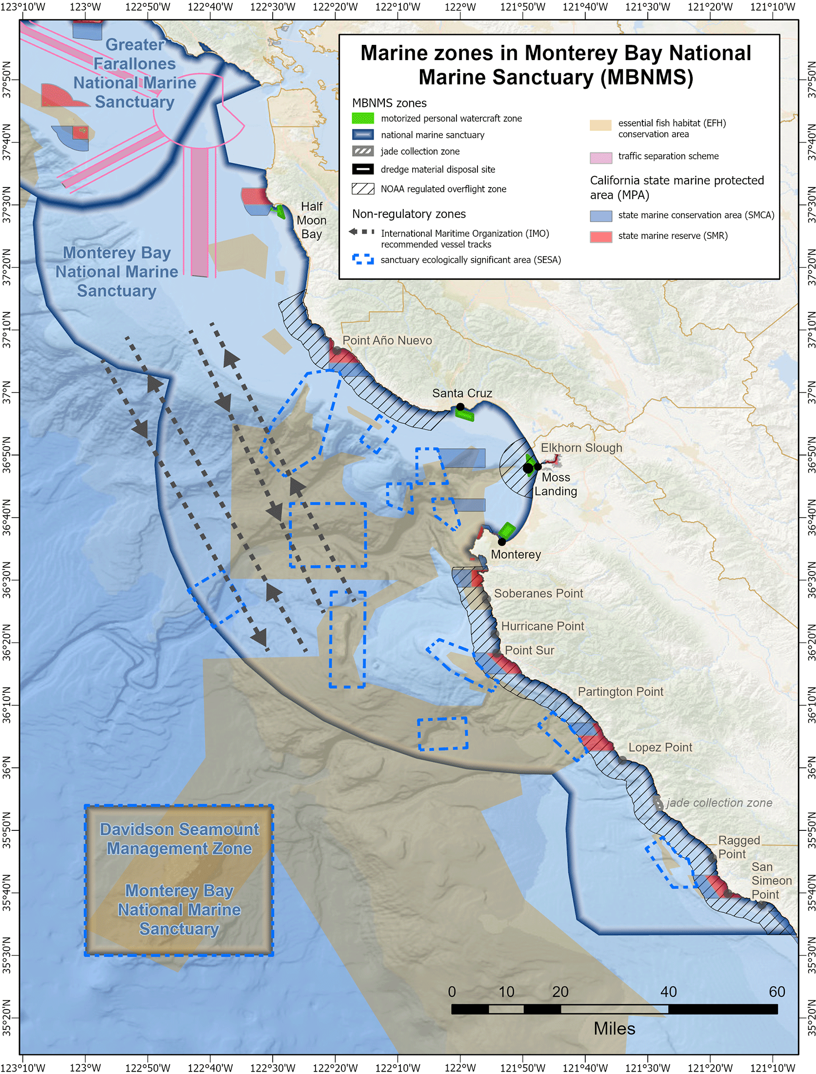
MBNMS Marine ZonesThis map combines a variety of marine zones in MBNMS, including NOAA regulated overflight zones, MPWC zones, Military Training zones, Jade Collection zones, and Dredge Disposal zones.
|
||
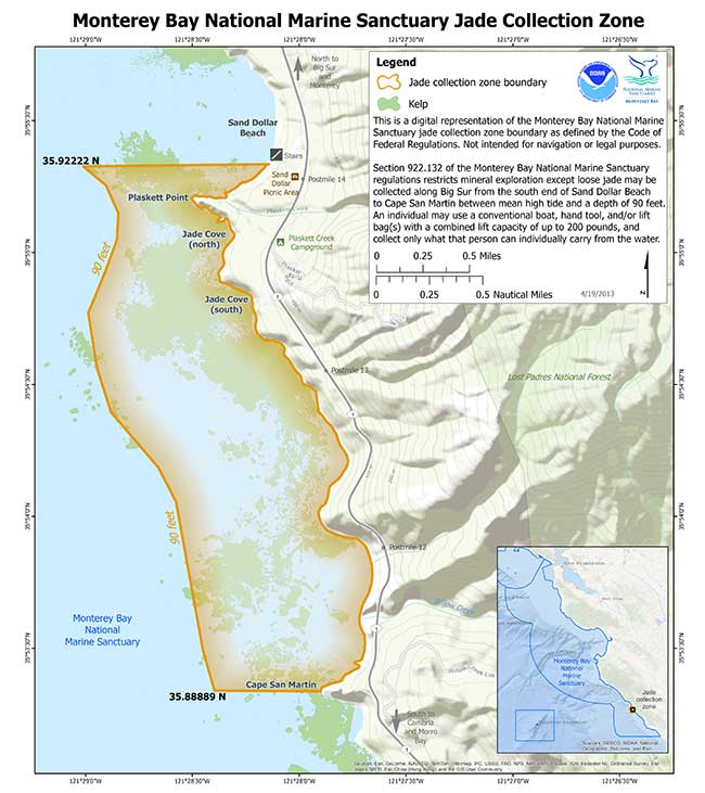 |
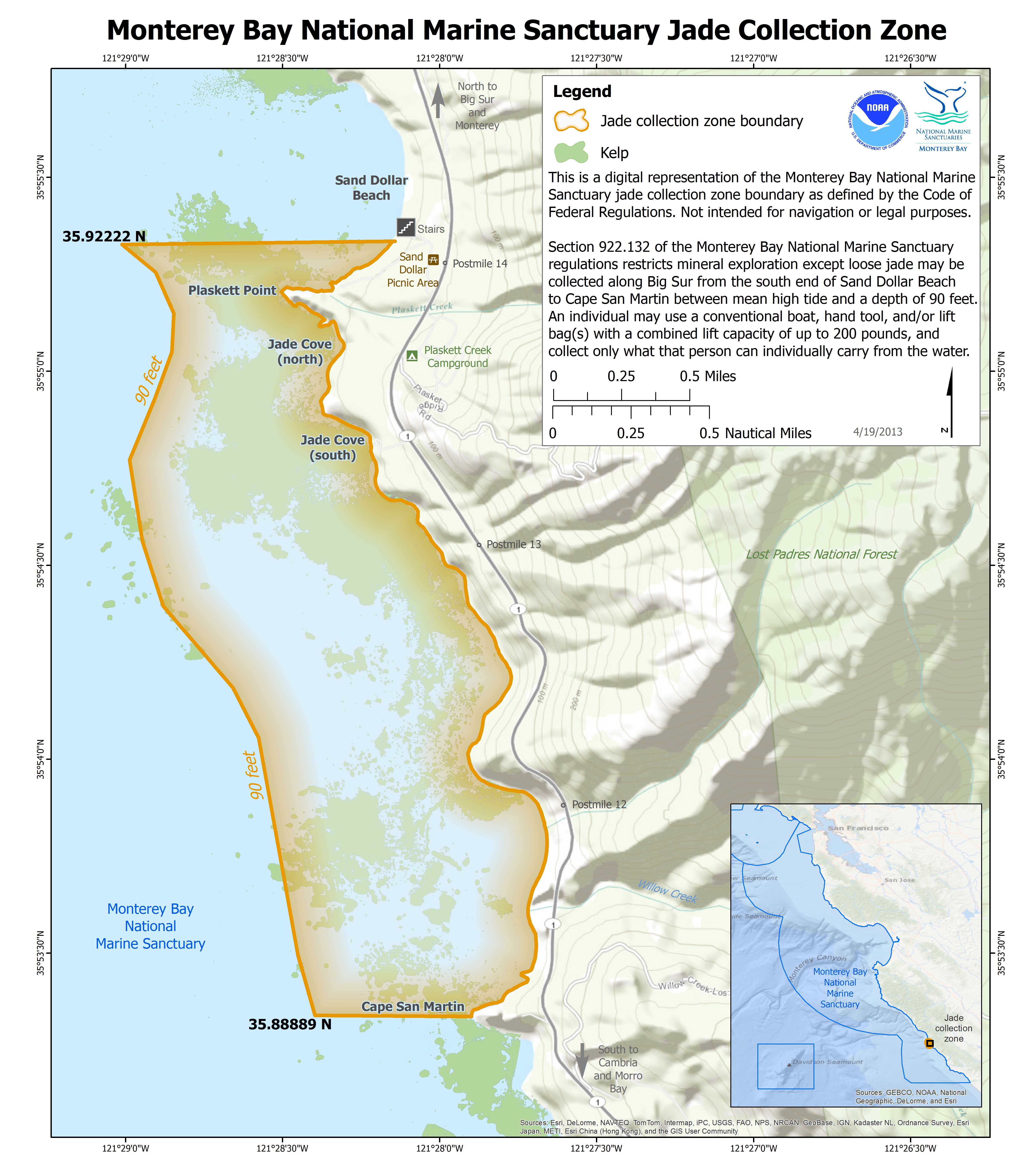
MBNMS Jade Collection AreasCollecting loose jade in specific designated areas is allowed within the MBNMS.
|
||
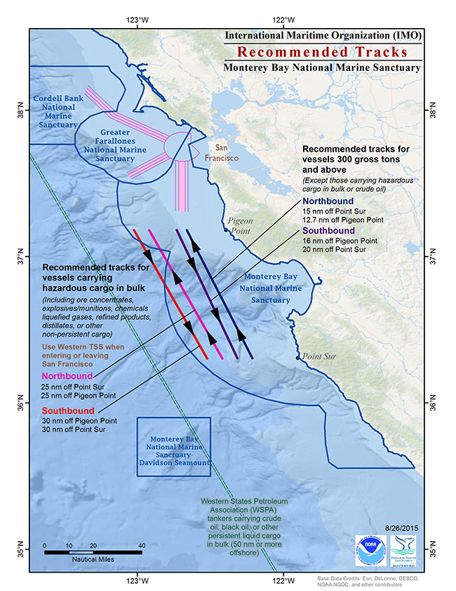 |
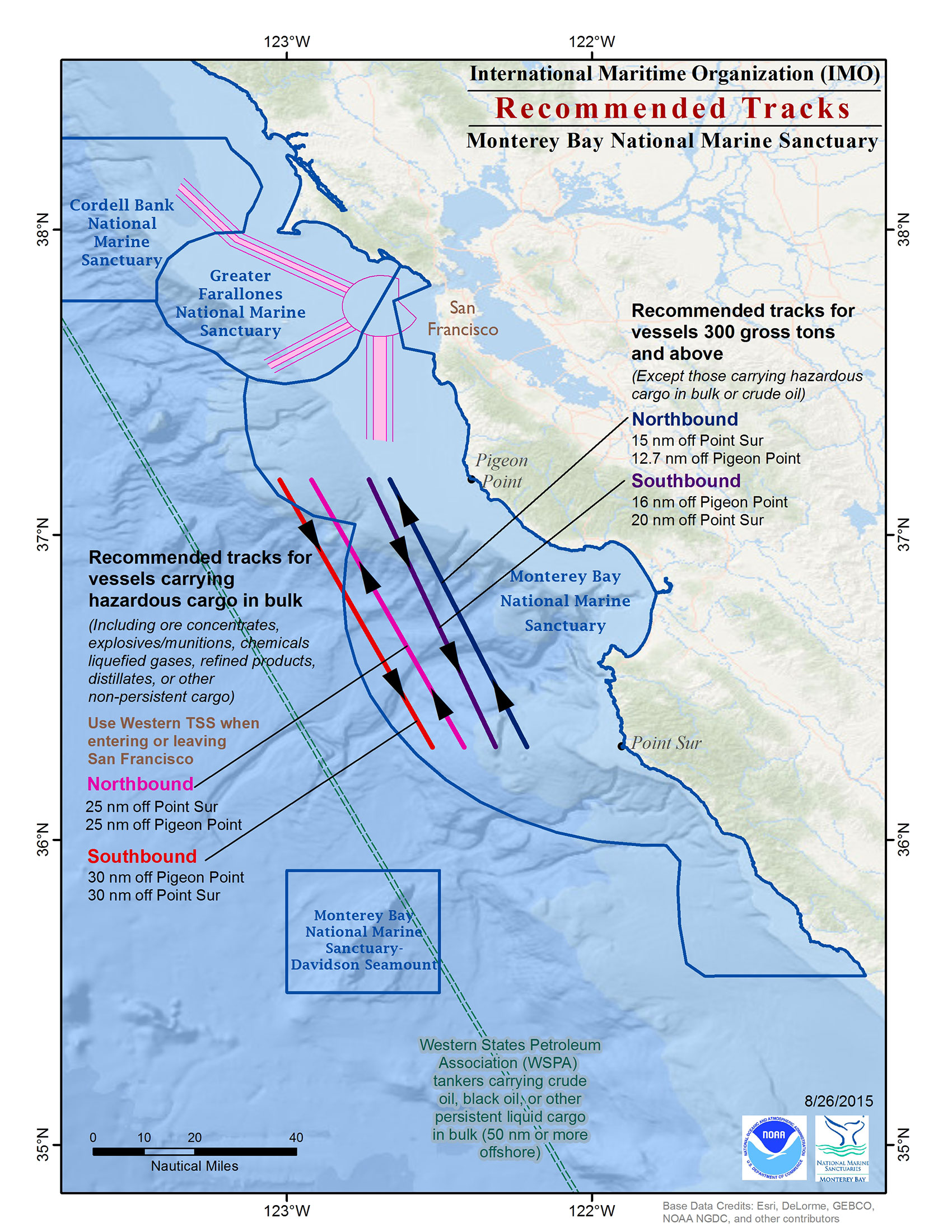
Recommended Vessel TracksEffective and safe vessel traffic management within the Monterey Bay National Marine Sanctuary is ensured by vessels following these tracks. Please visit the following web page for more information.
|
||
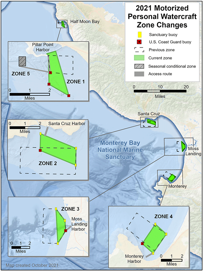 |
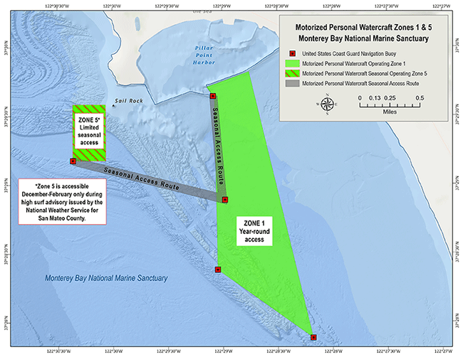
Motorized Personal Watercraft Use MapMotorized Personal Watercraft use zones. Map showing the four designated zones and access routes within the Sanctuary, with overlay of pinniped haul-out and seabird nesting areas. Please visit the following web page for more information.
|
||
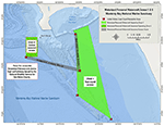 |
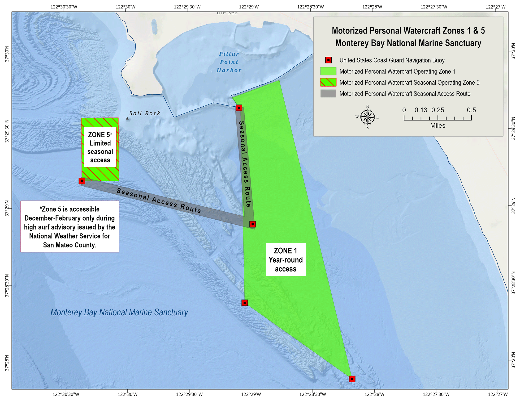
Motorized Personal Watercraft Use Map - Zone 5
|
||
 |
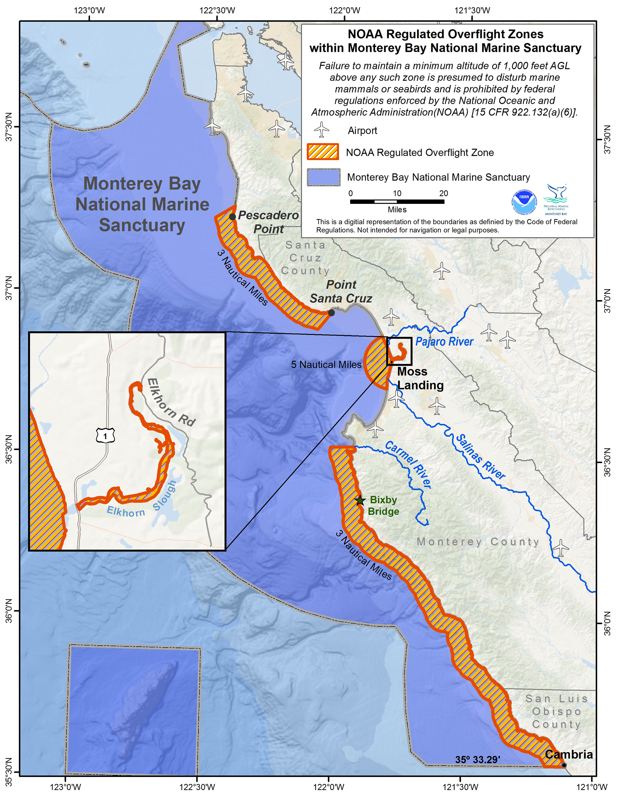
Overflight MapGIS map illustrating the four NOAA regulated overflight zones. Please visit the following web page for more information.
|
||
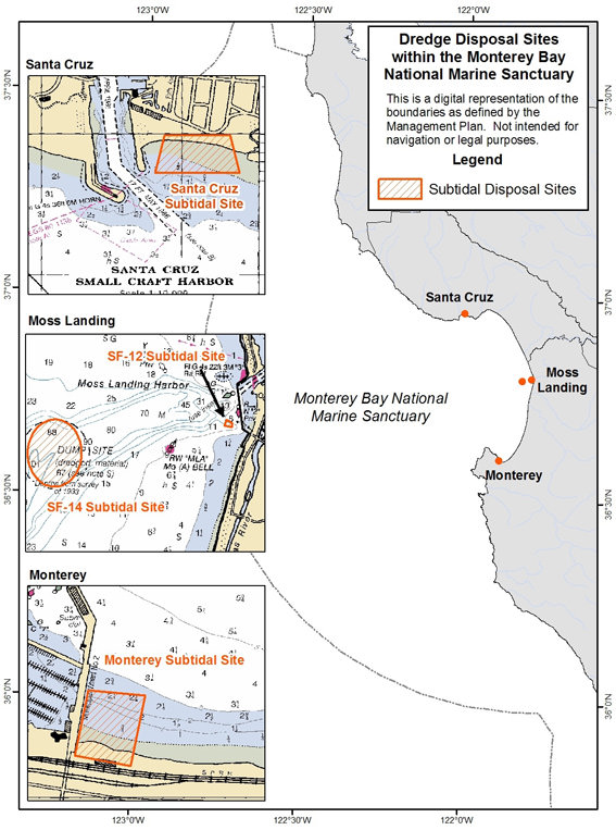 |
Dredging MapDredging sites for the four harbors in the MBNMS including Pillar Point, Moss Landing, Santa Cruz and Monterey harbors. Please visit the following web page for more information.
|
||
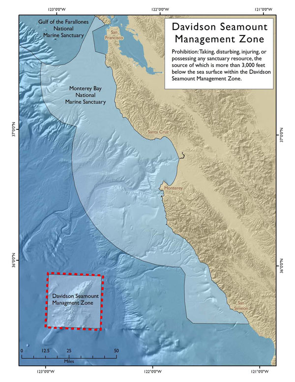 |
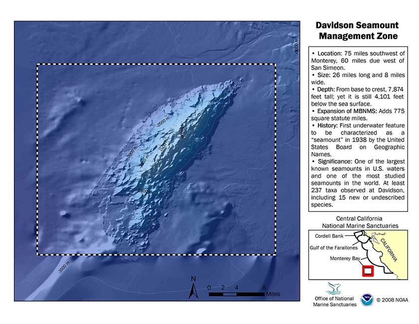
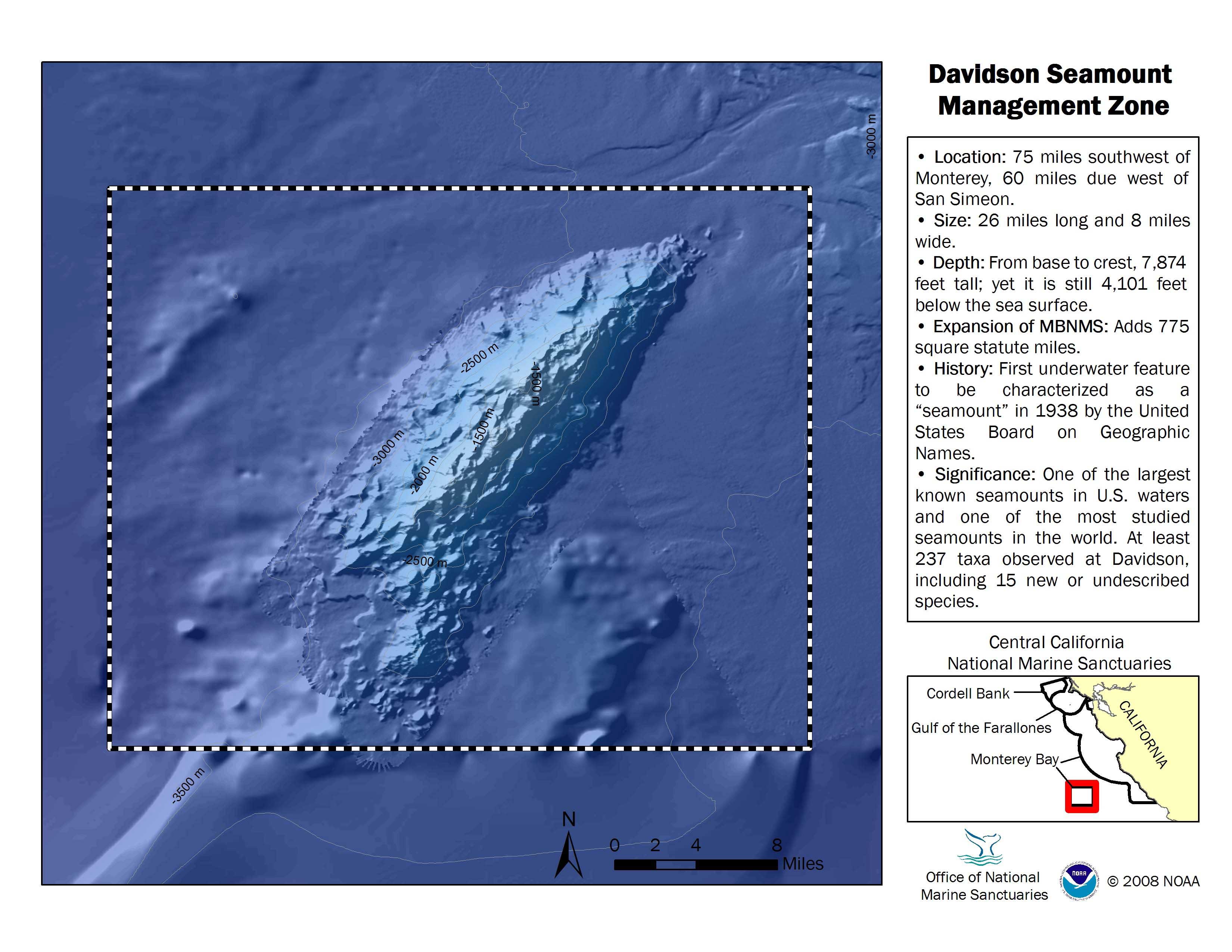
Davidson Seamount Management ZoneTaking, disturbing, injuring, or possessing any sanctuary resource, the source of which is more than 3,000 feet below the sea surface within the Davidson Seamount Management Zone, is prohibited.
|
||
 |
|
||
|
|||
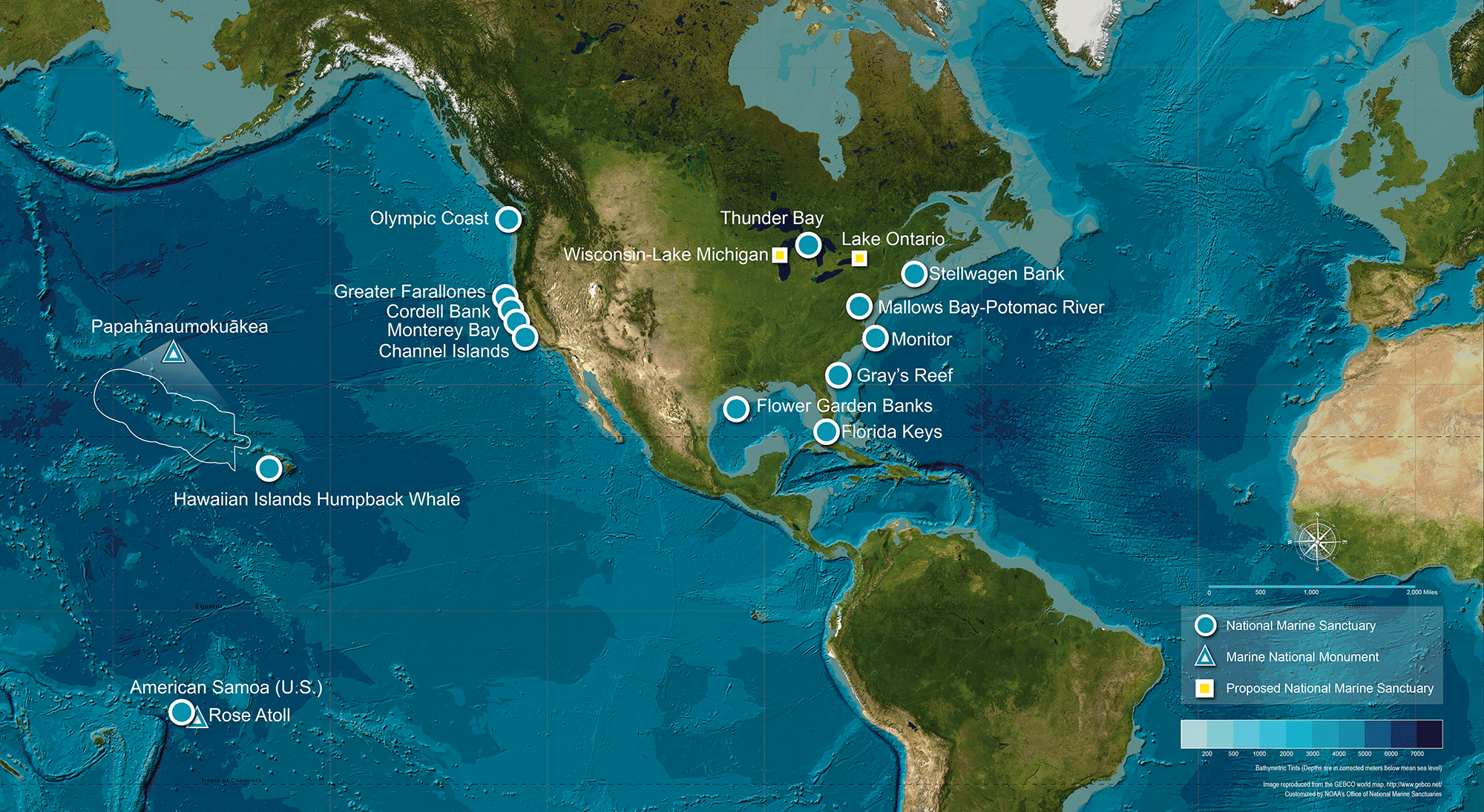 |
Office of National Marine Santuaries Satellite MapSatellite based map of all of the National Marine Sanctuaries and the National Marine Monument in the United States. Please visit the following web page for more information.
|
||
 |
Atlas MapsMaps of each national marine sanctuary, including Monterey Bay. |
||