Physical Oceanography
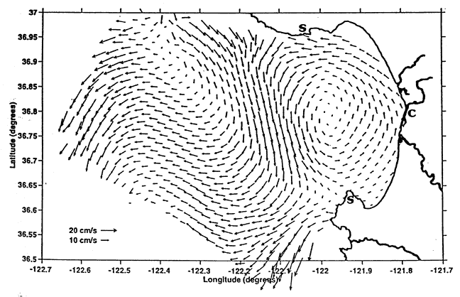
Figure 12
Mean radar-derived surface currents around Monterey Bay for the period August through September, 1994 based on a maximum possible 666 two-hourly observations. Locations of the two SeaSonde systems (S) and the single CODAR system (C) are denoted by symbols along the shoreline. Paduan, et al. 1995, with permission.