
Cover
|
Monterey
Bay National Marine Sanctuary |
Final
Environmental |
|
| Volume I |
|
U.S. Department of Commmerce National Oceanic and Atmospheric Administration Sanctuaries and Reserves Division |
June 1992 |
|
 |
 |
|
UNITED STATES DEPARTMENT OF COMMERCE
FINAL ENVIRONMENTAL IMPACT STATEMENT
AND MANAGEMENT PLAN FOR THE PROPOSED
MONTEREY BAY NATIONAL MARINE SANCTUARY
June 1992
Prepared By:
Sanctuaries and Reserves Division
Office of Ocean and Coastal
Resource Management
National Ocean Service
National Oceanic and Atmospheric
Administration
1825 Connecticut Avenue, N.W., Suite 714
Washington, D.C. 20235
Title
Final Environmental Impact Statement and Management Plan for the Proposed Monterey Bay National Marine Sanctuary
The National Oceanic and Atmospheric Administration proposes to designate Monterey Bay and its adjacent waters, and the submerged lands thereunder, off central California as a national marine sanctuary. The proposed Sanctuary boundaries encompass an area of approximately 4,024 square nautical miles (approximately 13,800 square kilometers) of coastal and ocean waters. The northern terminus of the boundary is located along the southern boundary of the Gulf of Farallones National Marine Sanctuary and runs westward to approximately the 500 fathom isobath. The boundary then extends southward in an arc following the 500 fathom isobath to a point due west of Cambria. The boundary then extends shoreward towards the mean high-water line. The landward boundary is defined by the mean high-water line between the Gulf of Farallones National Marine Sanctuary and Cambria, exclusive of a small area off the north coast of San Mateo County and the City and County of San Francisco between Point San Pedro and Point Bonita.
Part I of this Final Environmental Impact Statement/Management Plan (FEIS/MP) reviews the authority for Sanctuary designation, the goals of the National Marine Sanctuary Program, the purpose and need for designating a national marine sanctuary at Monterey Bay, the socioeconomic consequences of designation, the manageability of the area and the Sanctuary designation process.
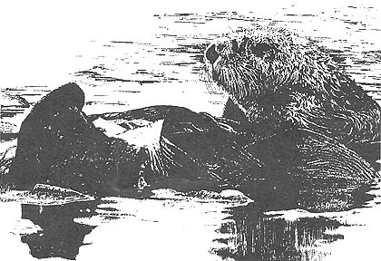
Part II of the FEIS/MP describes the study area used for determining a final preferred boundary alternative, including human uses, natural resources, and the existing resource protection regime. The area recommended for the proposed Sanctuary, preferred boundary alternative 5 (approximately 4,024 square nautical miles), provides the habitat and setting for a distinctive assortment of living and non-living marine resources.
Part III examines the alternatives considered in developing the proposal to designate a national marine sanctuary at Monterey Bay. These alternatives were considered in terms of achieving optimum protection for the ecosystem, improving scientific knowledge of the area, promoting public understanding of the value of Bay area resources, minimizing overlap with existing jurisdictions and minimizing any negative impacts to the area's income generating activities. Based on these criteria, preferred boundary, management, and regulatory alternatives were selected. Part IV of the FEIS/MP describes the environmental consequences associated with each of these alternatives.
Part V describes the management plan for the proposed Sanctuary. This plan contains guidelines and goals to ensure that all management actions undertaken after designation are directed to resolving important issues as a means of meeting Sanctuary objectives. Management actions are considered in four program categories: (1) Resource protection; (2) Research; (3) Education; and (4) Administration.
Lead Agency: |
U.S. Department of Commerce National Oceanic and Atmospheric Administration National Ocean Service Office of Ocean and Coastal Resource Management |
Contact: |
Rafael V. Lopez, Pacific Regional Manager Sanctuaries and Reserves Division Office of Ocean and Coastal Resource Management National Ocean Service/NOAA 1825 Connecticut Avenue, N.W., Suite 714 Washington, D.C. 20235 (202) 606-4126 |