Physical Oceanography
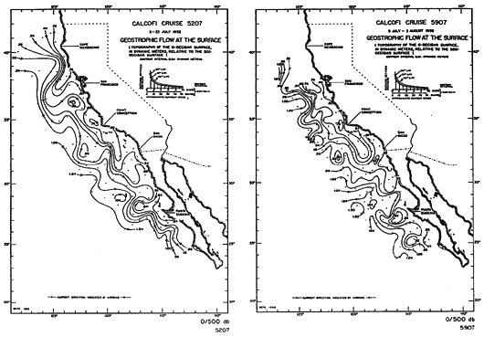
Figure 2
Dynamic topography map of the California Current for individual cruises, Left: July 1952, Right: August 1959. These maps were chosen to show the large variability in geostrophic flow in the MBNMS. From Wylie (1966).